Walk #2
Date: 24th April
Time: 6.00pm
Where: Dormansland
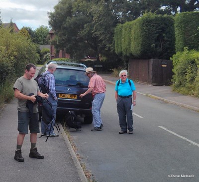
Parking: There is limited parking at The Plough; best bet is in Ford Manor Road (the start of the walk)
Route:
Lots of opportunities to bail out early if the weather turns bad  . The route was OK when I checked it a couple of weeks ago (except for one stretch which I’m now bypassing). Was a bit muddy on top last weekend but shouldn’t be too bad if the weather holds…
If anyone’s late the plan is to go clockwise round the route.
GPX file (suffix changed to .txt):
Map:
Report:
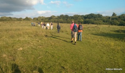
As usual we probably picked the worst evening of the week weather-wise for the walk – however, on this occasion, this meant only that it was a bit chilly and overcast. No rain and also dry underfoot.
This was probably a record turnout: a total of 20 people or thereabouts which even beats the Ditchling walk (see the picture at the top of the 2010 archive), so well done to all who turned out (particularly the newbies from the Fairwarp walk who didn’t allow the appalling weather then to put them off). A warm welcome to the new walkers and those returning from long layoffs.
The walk went as planned (despite the determined efforts of one or two to head in different directions) and a good pace was kept up by all with the group only really breaking up as we relaxed along the home stretch.
For the record I think the list of attendees was (in no particular order): Franklyn, Simon F., Sonika, Maud, Steve M., Andy S. & Bertie, Neal Z, Graham B., Roy, Phil C., Andy D., Pete F., Ian C., Lee, Hema, Gail, Marcela and Mark (apologies to anyone I’ve missed/mis-spelt). DT’s excuse of the week: painting the kitchen.
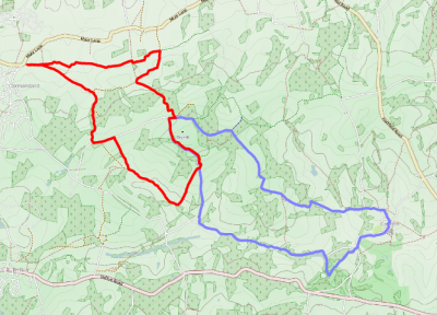
What we did (in red) and previous route in 2008 (Cowden).